The current Irish standard I.S. EN ISO 22282 series governs geotechnical hydraulic testing, and in Ennis, where the River Fergus and its tributaries shape both the landscape and the subsurface, applying it correctly makes all the difference. Much of the town rests on glacial till overlying karstified Carboniferous limestone, a sequence that produces highly variable hydraulic conductivity even within a single site. A desk study alone cannot resolve whether the till acts as an aquitard or whether open fissures in the bedrock will connect excavations directly to the regional groundwater table. The Lefranc test provides reliable point measurements in soil and weathered rock, while the Lugeon test quantifies fracture flow in the underlying limestone, which is essential when designing permanent dewatering or assessing contamination pathways near the Fergus. Contractors and consultants working on the Ennis Data Centre campus or residential schemes off the Clare Road have learned that ignoring this variability leads to tender-stage surprises. We run these tests from our mobile laboratory, interpreting packer test data against local borehole logs so that the permeability values fed into groundwater models genuinely reflect conditions beneath the site.
In Ennis, the difference between a 2-Lugeon and a 20-Lugeon rock mass is the difference between a dry excavation and a flooded one.
Methodology applied in Ennis
Critical ground factors in Ennis
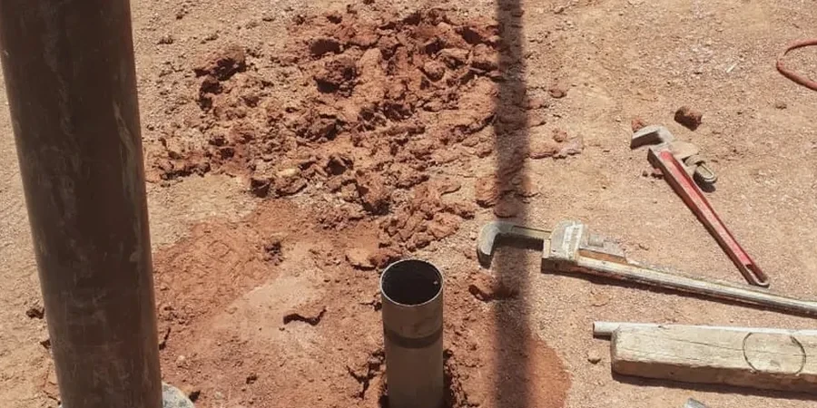
The Lugeon test uses a single or double packer assembly lowered into an NQ or HX borehole to isolate a test interval, typically 3 to 5 metres long, while a constant-pressure water injection is maintained from a header tank at the surface. In Ennis, where artesian conditions occasionally develop in the confined limestone beneath the till, we install a pressure transducer at packer depth to correct for the natural head and avoid overestimating the flow rate. Skipping that correction can inflate the Lugeon value by 30 % or more, leading to oversized dewatering systems and unnecessary cost. The bigger risk, however, is hydrofracturing: if injection pressure exceeds the in-situ minimum stress, the test artificially opens fissures and produces permeability values that do not represent the undisturbed rock mass. The I.S. EN ISO 22282-3 standard defines a maximum test pressure envelope precisely to prevent this, and our technicians follow it strictly, calculating the limit based on overburden depth and estimated fracture gradient before each stage. For sites within the Fergus floodplain, where the water table sits barely a metre below ground level in winter, we also run Lefranc tests at multiple horizons to detect perched water that could destabilise temporary slopes during construction.
Our services
Our Ennis-based testing programme covers the full sequence from glacial deposits to karst bedrock, ensuring that groundwater models used for Environmental Impact Statements and EPA licence applications are built on measured data rather than assumptions.
Lefranc variable-head tests in overburden
Determines hydraulic conductivity in the boulder clay and sandy gravel lenses above the limestone, using falling-head methods in cased boreholes with carefully prepared test sections.
Lugeon packer tests in Carboniferous limestone
Quantifies fracture permeability through single or double packer assemblies, with stage-by-stage pressure control to detect dilation and washout effects in karstified rock.
Groundwater monitoring installation
Design and installation of standpipe and vibrating-wire piezometers in separate horizons, enabling seasonal water-level tracking required under the Clare County Council planning conditions.
Permeability correlation studies
Cross-plotting field test results with laboratory falling-head tests on Shelby tube samples and grain-size distributions, providing the design team with a calibrated hydrogeological model.
Questions and answers
What is the difference between a Lefranc test and a Lugeon test, and which one do I need in Ennis?
A Lefranc test measures permeability in unconsolidated soils such as the glacial till found across Ennis, using an open borehole section without packers. A Lugeon test uses inflatable packers to isolate a segment of bedrock and injects water under controlled pressure to measure fracture flow in the limestone. Most Ennis sites require both: Lefranc in the overburden to assess excavation stability and Lugeon in the bedrock to design permanent dewatering or confirm whether a basement will require tanking.
How much does a field permeability testing programme cost in Ennis?
A typical programme combining two to three Lefranc tests and a multi-stage Lugeon profile in a single borehole ranges from approximately €570 to €1080, depending on the number of test intervals, packer configuration, and whether overnight stabilisation periods are required. The final scope is best defined after reviewing the site investigation borehole logs and the target depths specified by the design engineer.
Why does the Lugeon test require a maximum pressure limit, and what happens if it is exceeded?
The I.S. EN ISO 22282-3 standard defines a maximum test pressure to prevent hydraulic fracturing of the rock mass. Exceeding this pressure can artificially open closed fissures or create new fractures, producing permeability values far higher than the true in-situ condition. In the thinly bedded limestones beneath Ennis, this is particularly critical because the bedding planes can open at relatively low injection pressures, giving a misleading impression of high permeability that does not exist under natural groundwater gradients. More info.