The River Fergus floodplain defines Ennis. Beneath the town’s medieval streets, soft alluvial silts and clays extend to depths of 8 to 15 metres, overlying karstified Carboniferous limestone. Water table sits barely two metres down in winter. For any tunnelling project here, the real challenge isn't the rockhead—it's the squeezing ground above it. Our team has worked on multiple Clare County Council infrastructure assessments where undisturbed sampling in these low-strength units proved critical. Without a site-specific geotechnical analysis for soft soil tunnels, predicting face stability and surface settlement becomes guesswork. We routinely pair in-situ pressuremeter testing with laboratory CU triaxial tests to define the undrained shear strength profile that governs temporary support design. For deeper investigations through the transition zone into limestone, a CPT test can map the soft-to-firm boundary without gaps in the data record.
In Ennis, the soft floodplain silts dictate tunnel behaviour far more than the limestone beneath them—get the undrained shear strength wrong, and you'll chase settlements for the life of the structure.
Methodology applied in Ennis
Demonstration video
Critical ground factors in Ennis
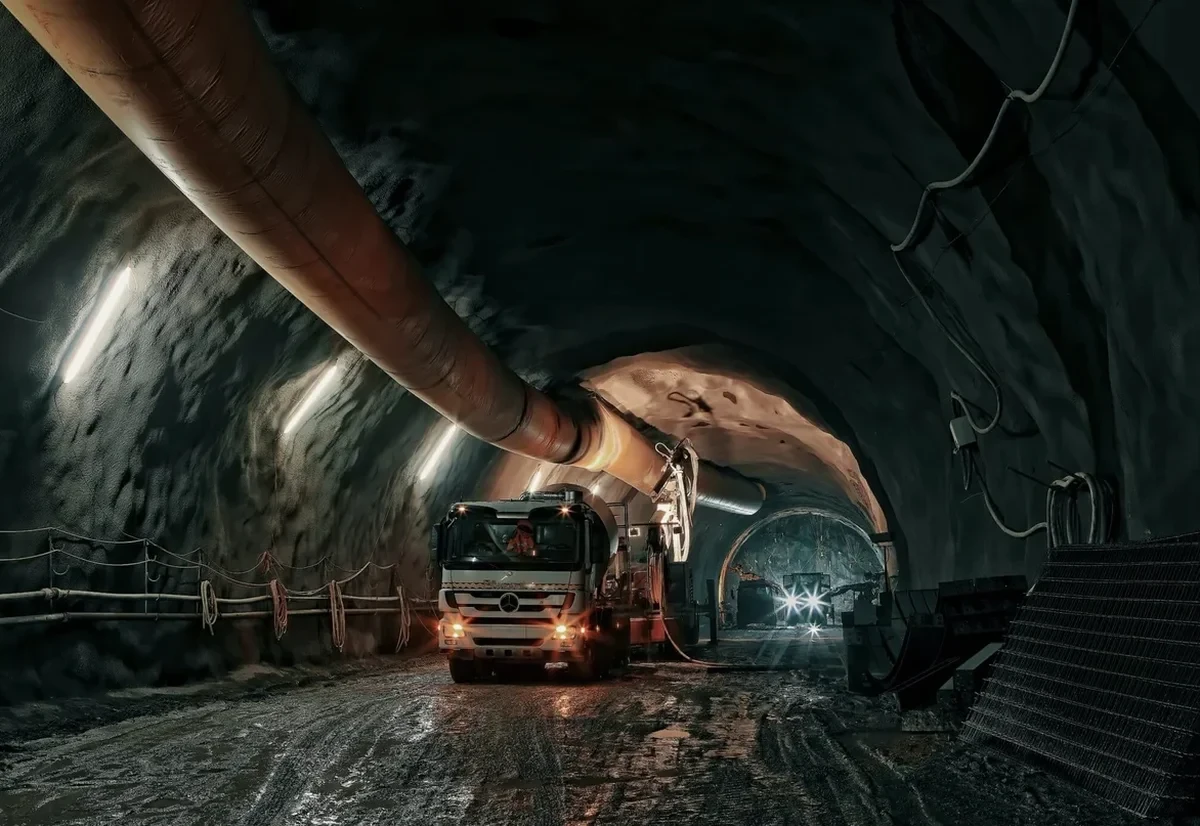
A microtunnel drive under the N85 near the Quin Road junction ran into trouble three years ago. The contractor expected stiff boulder clay. Instead, they hit a pocket of saturated peat and silt that had never appeared on the desk study maps. Face loss exceeded 300mm in two days, and the road surface began to crack. The repair bill ran to six figures. That job failed because the ground investigation stopped at six SPT boreholes spaced 80 metres apart. Soft ground tunnels in Ennis demand a different level of resolution. We push for continuous sampling across the full alignment, with at least one undisturbed sample per metre in the critical upper strata. The karstic rockhead adds a second failure mode: sudden loss of drilling fluid circulation into open cavities, which can destabilise the face in open-face shields. Our pre-construction analysis maps both the soil behaviour and the potential karst features using a combination of rotary coring and downhole geophysics.
Our services
Our Ennis-based geotechnical programme for soft ground tunnels covers the full chain from borehole planning to numerical model input parameters. We deliver data packages that a tunnel design engineer can use directly in PLAXIS or FLAC3D without re-interpretation.
Soft Ground Tunnel Parameter Definition
We design and execute a ground investigation specifically for the tunnel alignment, including thin-walled tube sampling, CU and UU triaxial testing, incremental oedometer tests, and in-situ pressuremeter profiles. The output is a parameter set for Mohr-Coulomb or Hardening Soil models, with layer-by-layer stiffness, strength, and consolidation data calibrated to the Ennis floodplain stratigraphy.
Karst Hazard Assessment for Tunnelling
Where the tunnel transitions into the Carboniferous limestone, we combine rotary core drilling with downhole camera surveys and packer permeability testing. The objective is to identify open cavities, weathered zones, and high-permeability fractures that could cause sudden water inflow or face instability during excavation. We deliver a karst risk map along the alignment.
Questions and answers
What is the cost of a geotechnical analysis for a soft ground tunnel in Ennis?
For a tunnel alignment investigation in the Ennis area, budgets typically range from €4,360 for a limited scope covering a short drive length with targeted sampling, up to €15,250 for a comprehensive programme that includes continuous undisturbed sampling, multiple triaxial suites, oedometer testing, and karst hazard assessment along the full alignment. Variables that influence the final figure include the total length of tunnel, depth to rockhead, access constraints in the urban centre, and the number of laboratory test packages required to satisfy the Eurocode 7 design requirements.
Which laboratory tests matter most for tunnels in soft alluvial soils?
The two most critical test types are consolidated-undrained (CU) triaxial tests with pore pressure measurement and incremental loading oedometer tests. The CU triaxial gives you the effective stress parameters (c' and φ') and the undrained shear strength profile that controls face stability calculations. The oedometer provides the stiffness parameters—compression index Cc, recompression index Cr, and the coefficient of secondary consolidation Cα—that feed directly into settlement predictions. For the organic silts common around the River Fergus, we also run loss-on-ignition tests to quantify organic content, because anything above 2% significantly increases long-term creep settlement.
How do you handle the transition from soft ground to limestone in Ennis?
The transition zone is where most tunnelling problems occur. We approach it with a dual investigation: continuous sampling through the soil using thin-walled tubes, then switch to rotary core drilling once the auger refusal indicates rockhead. We log the core for karst features—solution cavities, weathered seams, iron staining—and run packer tests to measure hydraulic conductivity in the upper rock mass. The interface is rarely flat in karst terrain; it can vary by several metres over short distances. Our borehole layout accounts for this by placing investigation points at closer spacing near the anticipated transition, typically every 15 to 20 metres rather than the 50-metre spacing used in uniform ground.
What Irish and European standards apply to this type of investigation?
All our work follows the Eurocode 7 framework with the Irish National Annex. The key standards are I.S. EN 1997-2:2007 for ground investigation and testing procedures, I.S. EN 1997-1:2004+A1:2013 for geotechnical design principles, I.S. EN ISO 22475-1:2021 for sampling methods and groundwater measurements, and the I.S. EN ISO 17892 series for laboratory testing of soils. For the karst assessment component, we also reference the Irish Geological Heritage Programme mapping and any available GSI karst database records for the Ennis area.