Ennis grew around its medieval friary on the banks of the River Fergus, and that river has dictated nearly a millennium of construction decisions here. The town sits squarely on Carboniferous limestone, a formation riddled with solution features, buried channels, and variable overburden that can turn a straightforward site into a geological puzzle. Foundation design in this part of County Clare demands more than just a borehole log—it needs a continuous picture of what lies between the boreholes. Electrical resistivity testing and Vertical Electrical Sounding provide exactly that, mapping subsurface variations without disturbing the ground. We run resistivity surveys across sites from the Quin Road commercial corridor to older residential pockets near the town centre, helping developers and consulting engineers identify karst cavities, assess bedrock depth, and delineate groundwater pathways before committing to excavation or piling. The method works by injecting a controlled current into the ground through electrode arrays and measuring the resulting potential difference, which translates into a resistivity profile that distinguishes saturated clays from competent limestone or granular alluvium. Having processed thousands of linear metres of resistivity data across Ireland's western limestone region, our technical team understands how the Fergus floodplain deposits and glacial tills create the resistivity contrasts that make or break a site investigation programme. Every survey is calibrated against local borehole control where available, and all data processing follows the procedures set out in the relevant I.S. and British Standard guidance for geophysical site investigations.
In Ennis's karst limestone, a 20-metre gap between boreholes can hide a dissolution feature large enough to swallow a foundation—resistivity imaging fills that gap.
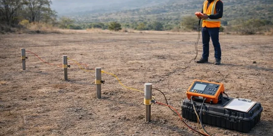
Methodology applied in Ennis
Critical ground factors in Ennis
Ennis lies at approximately 3 metres above sea level along the River Fergus, and the combination of low-lying topography with karstified bedrock creates a flood-and-sinkhole risk profile that few other Irish county towns share. The November 2009 flooding event saw the Fergus overtop its banks and inundate parts of the town centre, reminding everyone that surface water and subsurface drainage are intimately connected here. Electrical resistivity data becomes a long-term risk management tool in this context: a low-resistivity anomaly mapped beneath a proposed building footprint may indicate a clay-filled dissolution pipe that acts as a preferential drainage path during heavy rainfall, or a water-filled cavity that could collapse under foundation loading. The Office of Public Works flood mapping and Geological Survey of Ireland karst database both acknowledge the complexity of the Ennis subsurface, and planning authorities increasingly expect developers to demonstrate that their site investigation has addressed karst hazard. A resistivity survey performed to I.S. EN 1997-2 standards provides that demonstration, documenting the continuity of rockhead and flagging anomalous zones for targeted follow-up by drilling or probe testing.
Our services
Resistivity surveys in Ennis are rarely a standalone exercise—they work best when integrated with direct investigation methods that ground-truth the geophysical interpretation. The service packages below reflect the typical requirements for sites in the Clare limestone region.
2D Resistivity Tomography for Site Investigation
A multi-electrode resistivity profile across your Ennis site, processed into a colour-contoured cross-section showing interpreted geology, bedrock surface, and any low-resistivity anomalies that may indicate karst features or groundwater. Suitable for foundation design, road schemes, and pre-purchase due diligence on development land.
VES Soundings for Groundwater and Deep Targets
Vertical Electrical Sounding using Schlumberger array expansion to map resistivity variation with depth at a specific location. Commonly used for groundwater exploration, well siting, and assessing the depth to bedrock where lateral access for a full 2D line is restricted. Each sounding includes modelled layer resistivities and thicknesses with confidence intervals.
Questions and answers
How much does an electrical resistivity survey cost for a site in Ennis?
For a typical residential or small commercial site in Ennis, a 2D resistivity survey with one or two profile lines generally falls between €540 and €870, depending on the line length, electrode spacing, and terrain conditions. Larger sites requiring multiple lines, deeper penetration, or VES soundings will exceed that range. Every survey is quoted individually after we review the site location, access constraints, and your investigation objectives—we never apply a flat rate without understanding the geology first.
Can resistivity testing detect caves and sinkholes in limestone?
Yes, and in Ennis this is one of the primary reasons clients commission resistivity work. Air-filled cavities produce very high resistivity anomalies, while clay- or water-filled dissolution features show up as low-resistivity zones relative to the surrounding limestone. The resolution depends on the electrode spacing and the depth of the feature, but features as small as 1–2 metres in diameter can be identified when they sit within the upper 15 metres of the profile. We always recommend following up any significant anomaly with a targeted borehole or probe to confirm the interpretation.
What standards apply to geophysical ground investigation in Ireland?
Our resistivity surveys are conducted in accordance with I.S. EN 1997-2:2007, which is the Irish adoption of Eurocode 7 Part 2 for ground investigation, supplemented by BS 5930:2015 for procedural guidance. We also reference ASTM D6431 where it provides useful methodological detail. The data processing and inversion follow the protocols embedded in RES2DINV, and all deliverables include a statement of methodology, equipment specifications, and the interpreted geological cross-sections with confidence annotations.