Ennis sits on Carboniferous limestone, which means karst features and variable rockhead depths are the norm here. Before you cut into the ground near the River Fergus or the historic town center, you need to know what the overburden is doing. The till deposits across County Clare can be loose to dense, and groundwater often appears just a few meters down. Our team runs continuous test pits to log the shallow profile and identify soft pockets before the main dig. We also use real-time in-situ permeability testing because the Fergus floodplain holds more water than most contractors expect. In a town where medieval foundations sit next to modern retail units, monitoring is not optional. It is the only way to protect adjacent structures, control settlement, and keep the project on schedule.
In limestone towns like Ennis, the real risk is not the rock you see but the void you don't. Monitoring catches the anomaly before it becomes a claim.
Methodology applied in Ennis
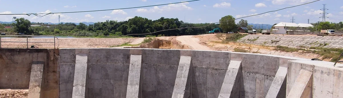
Critical ground factors in Ennis
A contractor on a three-storey apartment job near the Gort Road hit a water-bearing fissure at 4.5 meters. Within two hours, the excavation base was flooding and the shoring was losing passive resistance. They had settlement points on the adjacent house but no piezometer in the cut. The water pressure built up behind the soldier piles and the wall deflected 12 mm before they stopped work. We got called in to install standpipe piezometers and survey prisms overnight. The fix took three days and cost far more than the monitoring budget. The lesson: groundwater in Ennis limestone is connected. A drawdown two streets away can change your site conditions in an afternoon. We now specify at least one deep excavation instrumentation plan that covers water, movement, and vibration as a single integrated package.
Our services
Our Ennis monitoring packages are built around the specific risks of each site. We do not sell a one-size-fits-all sensor list.
Urban excavation monitoring
Full suite for projects in Ennis town centre: optical prisms on adjacent buildings, inclinometers behind shoring, and vibration sensors with SMS alerts.
Infrastructure and road dig control
Monitoring for ESB ducting, Irish Water mains replacement, and road widening. Includes pavement settlement markers and groundwater level loggers.
Karst risk instrumentation
Targeted arrays of piezometers and extensometers designed to detect cavity collapse or sudden water loss during excavation in limestone zones.
Questions and answers
What does a basic monitoring plan for a house extension in Ennis include?
For a small extension, we typically install 4 to 6 settlement points on the existing structure and 2 standpipe piezometers if the dig goes below 2 meters. The monitoring period runs from one week before excavation until two weeks after backfill. We provide a daily log and a final summary report.
How much does excavation monitoring cost in County Clare?
Instrumentation and monitoring for a typical Ennis project ranges from €870 for a basic short-term setup to €2,000 for a multiweek program with automated data logging, vibration sensors, and weekly engineer site visits. The final figure depends on the number of instruments, monitoring duration, and reporting frequency.
Do you install instruments before the dig starts?
Yes. We install baseline monitoring points at least five working days before excavation. This gives us a stable reference period. On karst sites we also run a 48-hour pumping test to check regional groundwater connectivity before any cutting begins.
How do you protect monitoring equipment during construction?
All surface points are set in protective steel boxes with high-visibility markings. Downhole instruments like inclinometer casing are grouted in place and capped with lockable steel covers. We provide the site foreman with a simple 'no-go' zone map so plant operators avoid sensor locations. If a sensor gets damaged, we replace it within 24 hours.